
(file photo)
The Antigua and Barbuda Meteorological Service has issued a Tropical Cyclone Alert for Antigua and Barbuda, the rest of the Leeward Islands, and the British Virgin Islands, as Tropical Storm Erin moves closer to the region.
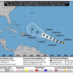
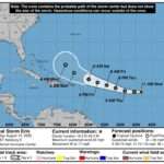
At 11 a.m., Erin was located near latitude 16.4°N and longitude 49.7°W, about 804 miles east of the Leeward Islands and 992 miles east of the British Virgin Islands. The storm is moving west at 17 mph, with maximum sustained winds of 60 mph and higher gusts. Tropical storm-force winds currently extend up to 60 miles from the center.
Forecasters expect Erin to strengthen into a hurricane by Friday, with the center most likely to pass north of the islands. However, the chance of storm-force winds reaching parts of the region remains moderate—around 40 to 50 percent for Anguilla and portions of the BVI, and lower for other islands.
")
Meteorologists warn that a slight southward shift or continued westward motion could bring the storm’s core dangerously close late Friday night or Saturday. Even without a direct hit, coastal swells are expected to increase, and heavy rainfall with strong gusty winds is possible.
The estimated minimum central pressure is 999 mb (29.50 inches).
While no watches or warnings are currently in effect, a Tropical Storm Watch could be issued later today or tonight. Residents are urged to closely monitor updates and prepare as the hurricane season continues.
The next advisory will be issued at 5 p.m., or sooner if necessary.

I’m urging everyone to take the official warnings seriously. Be prepared
Guys too many warnings in less than 12 hours, let’s be prepared
Thanka for keeping us informed