
Category 5 Hurricane Erin Rages North of the Leewards Islands
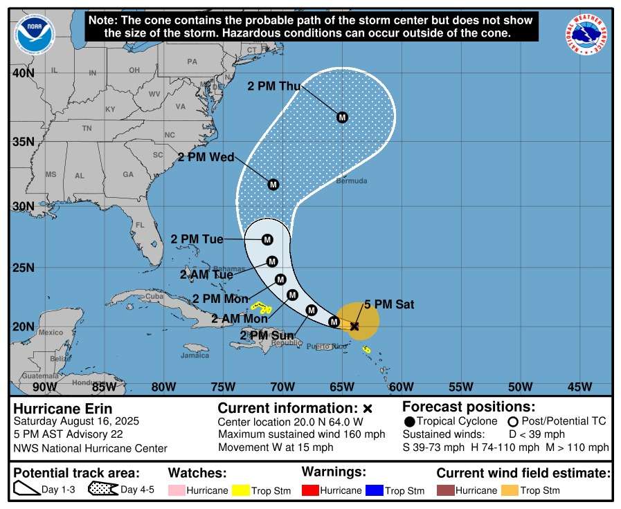
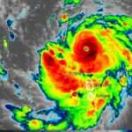
Hurricane Erin maintained its catastrophic Category 5 strength on Saturday evening as it continued to track northwestward, moving further away from the Leeward Islands after brushing dangerously close to the region.
The National Hurricane Center (NHC) said Erin is packing maximum sustained winds of 160 mph (260 km/h), with its eye located about 135 miles north-northwest of Anguilla at 5 p.m. AST. The storm is moving west at 15 mph but is expected to slow down and gradually turn north in the coming days.
Authorities in the Bahamas have now placed the Turks and Caicos Islands under a Tropical Storm Watch, joining St. Martin, St. Barthelemy, and Sint Maarten. Forecasters warn tropical storm conditions are possible in these areas within the next 12 to 48 hours.
Heavy rainfall continues to impact the northern Leewards, the Virgin Islands, and Puerto Rico. The NHC is forecasting 2 to 4 inches of rain, with isolated totals up to 6 inches, raising the risk of flash flooding, mudslides, and urban flooding in vulnerable communities.
Dangerous swells generated by Erin are also battering shorelines across the northeast Caribbean, creating life-threatening surf and rip currents. These conditions are expected to worsen as the storm moves closer to the Turks and Caicos and the southeastern Bahamas by late Sunday.
While Erin is projected to hold its current strength through the weekend, meteorologists expect gradual weakening to begin early next week.
Residents across the region are being urged to monitor official advisories and remain on high alert as the hurricane continues its path.

Even if it stays offshore, the psychological toll is heavy on these small islands. I’m just grateful that it is on the north of us.
Thank God there is no direct hit but let’s not be complacent