
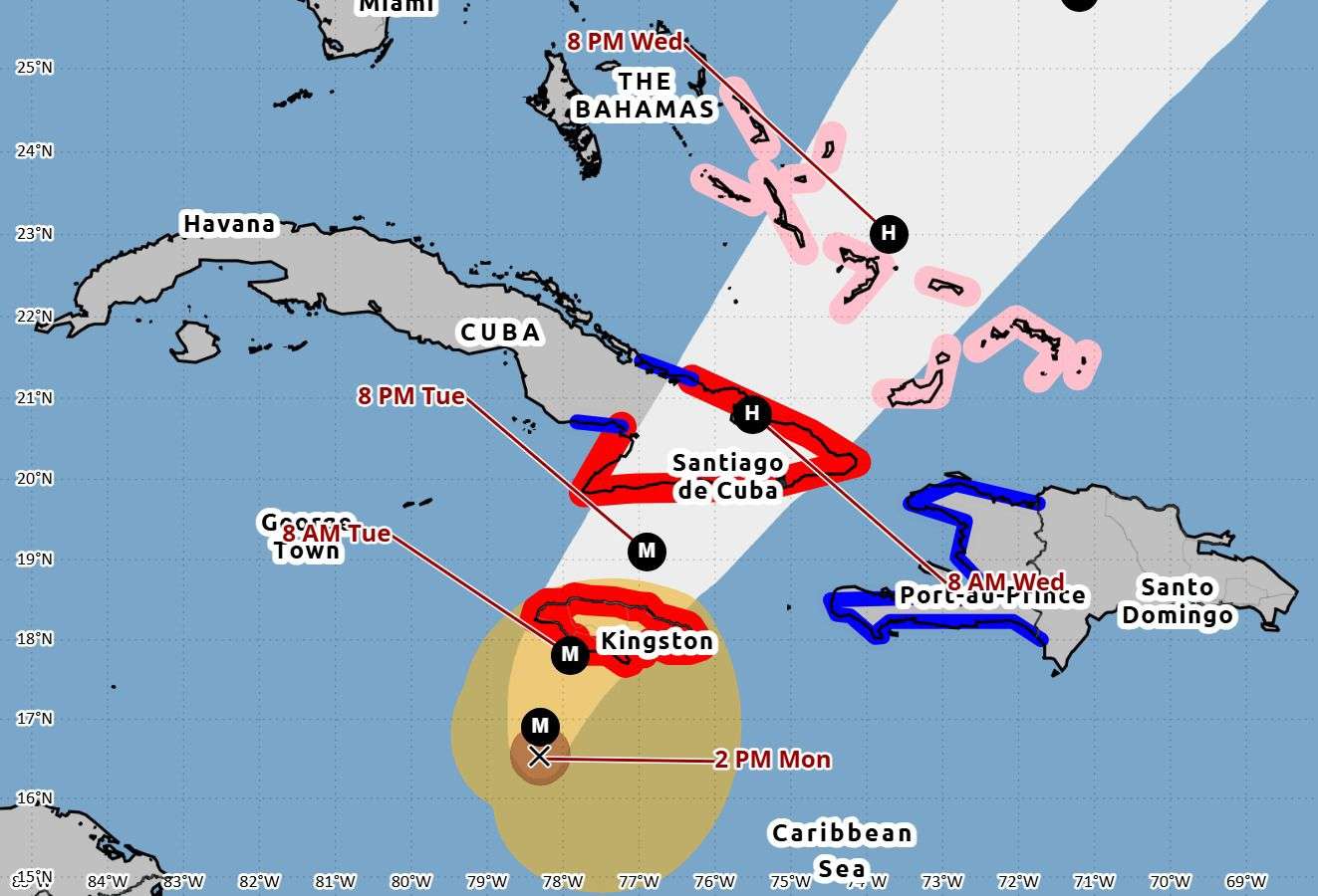
Hurricane Melissa has roared into a catastrophic “super” Category 5 storm, packing sustained winds of 175 miles per hour (280 km/h) as it edges closer to Jamaica. The eye of the hurricane was located about 145 miles (230 km) southwest of Kingston late Monday morning, moving slowly toward the west-northwest.
Forecasters at the National Hurricane Center warn that Melissa appears to have begun its long-feared turn toward the island — a shift that could bring the full force of the hurricane over Jamaica by tonight or early Tuesday.
The storm’s extreme winds, torrential rainfall, and powerful storm surge are expected to cause life-threatening conditions across much of the country. Authorities are urging residents to treat the situation with the utmost seriousness and to complete all emergency preparations immediately.
Hurricane warnings remain in effect for all of Jamaica and parts of eastern Cuba. Government shelters are open across the island, and emergency crews are on standby to respond once conditions allow.
Satellite imagery shows a clearly defined eye, a sign of Melissa’s immense power. Forecasters say the storm could maintain its Category 5 intensity as it nears land, with only slow weakening expected thereafter.
Residents have been advised to stay indoors, avoid flood-prone areas, and keep communication devices charged in case of power outages.
This marks the strongest hurricane to threaten Jamaica in recent memory, coming at the tail end of what has already been an exceptionally active Atlantic hurricane season.
Jamaica we are sorry. Be safe
Melissa really came out here looking for trouble. Stay safe out there, people. Don’t try to be a hero with this one