
Magnitude 3.7 Earthquake Recorded Near Antigua Early Saturday Morning
A magnitude 3.7 earthquake was recorded in waters near Antigua and Barbuda early Saturday morning, according to preliminary data from the University of the West Indies Seismic Research Centre (UWI SRC).
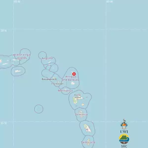
The tremor occurred at approximately 4:46 am. local time (8:46 UTC) on January 31, 2026, with its epicenter located at coordinates 17.58°N, 61.73°W at a depth of 12 kilometers.
The earthquake’s epicenter was positioned approximately 53 kilometers north-northeast of Saint John’s, Antigua and Barbuda, making it the nearest major population center to the seismic event.
Other nearby cities include Brades, Montserrat, located 102 kilometers northeast of the epicenter, and Basseterre, Saint Kitts and Nevis, situated 115 kilometers east-northeast.
The UWI SRC has issued a disclaimer noting that the location data was automatically calculated by computer algorithms and remains preliminary. The information is subject to potential revisions pending evaluation by SRC analysts who will review the seismic data.
The eastern Caribbean region sits along the boundary between the North American and Caribbean tectonic plates, making seismic activity relatively common in the area.


Never felt it. That’s the hour if the morning when the sleep sweet
God is good, could have been much worse.
I don’t understand these reporters even when the earthquake have my house dancing from left to right and right to left the news always report it occur near Antigua. I am living in Antigua I felt it in Antigua but it always reported near Antigua. How many Antigua do we have?