
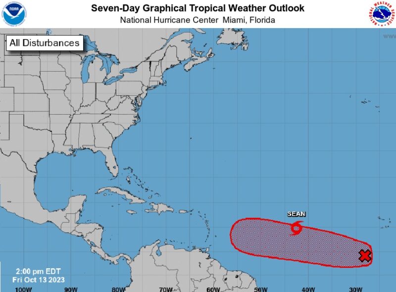
The US National Hurricane Center (NHC) has reported that a wide area of low pressure located several hundred miles south-southwest of the Cabo Verde Islands is producing disorganized showers and thunderstorms.
According to the NHC’s 5 pm update, the environmental conditions are expected to become more favorable for development by the end of the weekend as the disturbance moves westward across the central tropical Atlantic.
Additional development is expected afterward, and it is likely that a tropical depression will form early to the middle of next week as the system moves steadily westward across the central and western tropical Atlantic.
The disturbance currently has a 20% (low) chance of cyclone formation in the next 48 hours and an 80% (high) chance of formation in the next 7 days.
Meanwhile, the NHC reports that Tropical Storm Sean is struggling this afternoon. Sean is moving towards the west-northwest at a speed of 12 mph (19 km/h), with a turn towards the northwest expected later this evening, and this motion should continue for the next day or so.
Sean is then expected to turn back towards the west-northwest by Sunday. Maximum sustained winds are near 40 mph (65 km/h) with higher gusts. Additional weakening is anticipated, and Sean will likely become a post-tropical remnant low over the weekend.


0 Comments