

The government of Antigua and Barbuda has issued a Tropical Storm Watch due to the possible arrival of Tropical Storm Tammy.
The storm is also expected to affect other nearby areas such as Montserrat, St. Kitts, Nevis, Barbados, Dominica, Martinique and Guadeloupe.
Within the next 48 hours, tropical storm conditions are possible in the watch area. It is highly likely that additional watches and warnings will be required later today.
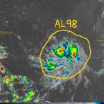
Tropical Storm Tammy is currently located at latitude 13.5 North and longitude 54.8 West, moving west at 17 mph (28 km/h).
It is forecasted to turn towards the west-northwest by tonight, followed by a turn towards the northwest on Friday night or Saturday. The center of the storm is expected to move near or over the Leeward Islands on Friday and Saturday.
Tammy currently has maximum sustained winds of 40 mph (65 km/h) with higher gusts. However, gradual strengthening is forecasted during the next few days, which could lead to Tammy being near hurricane intensity by the end of the weekend.

Tropical-storm-force winds extend outward up to 140 miles (220 km) from the center. The estimated minimum central pressure is 1006 mb (29.71 inches).
Tropical storm conditions are expected within the watch area beginning on Friday. Through Saturday night, Tammy is expected to produce storm total rainfall of 3 to 6 inches, with maximum amounts of 10 inches, across portions of the northern Windward into the Leeward Islands.
The British and U.S. Virgin Islands in eastern Puerto Rico are also expected to receive rainfall totals of 1 to 2 inches with maximum amounts of 4 inches.
These rains may produce isolated flash and urban flooding and mudslides in areas of higher terrain.
Furthermore, swells generated by Tammy will begin affecting portions of the Lesser Antilles later today.
These swells are likely to cause life-threatening surf and rip current conditions. It is advisable to consult products from your local weather office to stay informed and safe.

0 Comments