
The Antigua and Barbuda Meteorological Service is urging residents to keep a close watch on Tropical Storm Erin, which could strengthen into a hurricane by the end of the week and pass dangerously close to the northeast Caribbean.
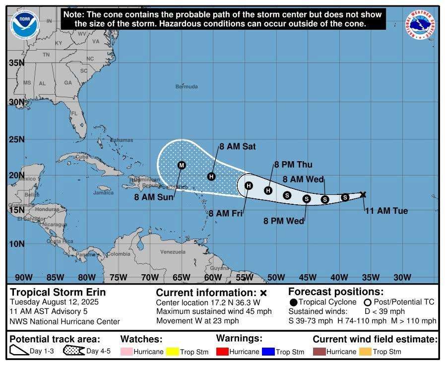
At 5 p.m. Tuesday, Erin was located about 1,544 miles east of the Leeward Islands and moving west at roughly 22 mph. The storm is packing maximum sustained winds of 45 mph with higher gusts. Little change in strength is expected over the next 24 hours, but forecasters anticipate gradual intensification starting late Wednesday. Erin is likely to reach hurricane status by Friday.
")
Current projections keep the storm’s centre north of the islands, but meteorologists warn that any shift southward could bring the core of the system uncomfortably close late Friday or Saturday. The chance of tropical-storm-force winds reaching the area has risen to around 33 percent.
No watches or warnings are currently in effect for Antigua, Barbuda, or neighbouring territories, but an alert could be issued as early as Wednesday.
Officials are advising residents in the Leeward Islands and British Virgin Islands to stay informed and prepare for the possibility of severe weather as the hurricane season continues.
The next update is scheduled for 5 p.m. Wednesday, or earlier if conditions change.

Guys let’s have our guards up to weather this storm! We can’t let this hit us by surprise
33% chance might not sound like a lot, but if it shifts south even a little, we could be in trouble. Better to be ready than sorry.
This is a critical time for residents to stay vigilant and get prepared.
We need just the rain lol
Comment *No one cares why the power is being taken away so much in New Hatton? The storm is coming