
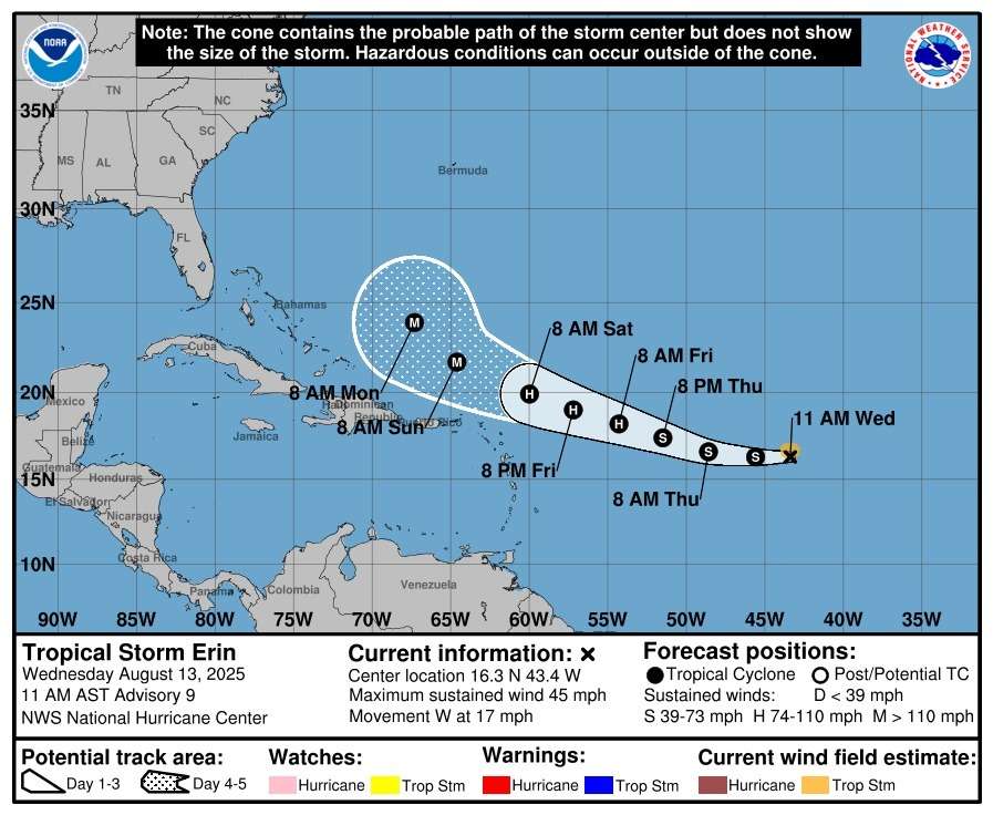
The U.S. National Hurricane Center reports that Tropical Storm Erin is moving west at 17 mph (28 km/h) and is expected to strengthen into a hurricane by Friday.
Climatologist Dale Destin says a TS Watch could be issued for Antigua and Barbuda by tomorrow.
At 11 a.m. AST Wednesday, Erin’s center was located near latitude 16.3°N, longitude 43.4°W, about 1,305 miles (2,100 km) east of the northern Leeward Islands. Maximum sustained winds are 45 mph (75 km/h) with higher gusts, and tropical-storm-force winds extend up to 60 miles (95 km) from the center.
")
Forecasters expect Erin to maintain its westward track through Thursday before turning west-northwest into the weekend, potentially passing near or just north of the northern Leeward Islands.
Swells generated by the storm could reach the northern Leeward Islands, Virgin Islands, and Puerto Rico this weekend, creating life-threatening surf and rip currents.

Time to get the shutters ready and make sure we have essentials stocked. Stay safe everyone
Life-threatening surf and rip currents? Definitely not worth taking chances at the beach this weekend.