
BERYL STILL A VERY DANGEROUS CATEGORY 4 HURRICANE

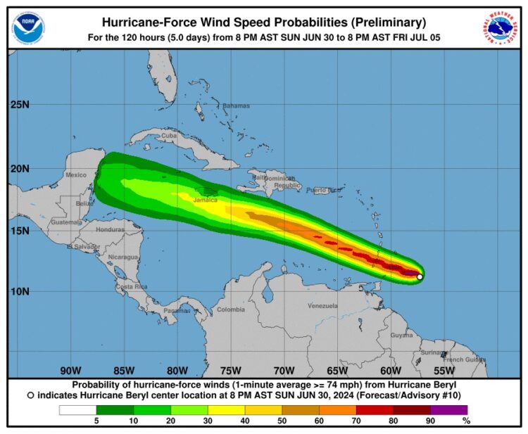
Summary as of 11:00 PM AST (0300 UTC)
- Location: 11.5°N, 58.1°W
- Distance from Barbados: 150 miles (240 km) southeast
- Distance from St. Vincent: 245 miles (390 km) east-southeast
- Maximum Sustained Winds: 130 mph (215 km/h)
- Movement: West at 20 mph (31 km/h)
- Minimum Central Pressure: 959 mb (28.32 inches)
Watches and Warnings
Current Warnings:
- Hurricane Warning: Barbados, St. Lucia, St. Vincent and the Grenadine Islands, Grenada, Tobago.
- Tropical Storm Warning: Martinique, Trinidad.
- Tropical Storm Watch: Dominica, South coast of the Dominican Republic (from Punta Palenque to the Haiti border), South coast of Haiti (from the Dominican Republic border to Anse d’Hainault).
Explanation of Terms:
- Hurricane Warning: Hurricane conditions are expected within the warning area. Preparations to protect life and property should be rushed to completion.
- Tropical Storm Warning: Tropical storm conditions are expected within the warning area within 36 hours.
- Tropical Storm Watch: Tropical storm conditions are possible within the watch area within 48 hours.
Discussion and Outlook
At 11:00 PM AST, the eye of Hurricane Beryl was located at 11.5°N, 58.1°W, moving west at 20 mph (31 km/h). This motion is expected to continue, with Beryl forecast to move across the Windward Islands Monday morning and then through the southeastern and central Caribbean Sea from late Monday to Wednesday.
Beryl remains a powerful Category 4 hurricane with maximum sustained winds of 130 mph (215 km/h). Fluctuations in strength are likely, but Beryl is expected to stay a dangerous major hurricane as it moves through the Windward Islands into the eastern Caribbean.

Hazards Affecting Land
- Winds: Hurricane conditions are expected in the hurricane warning areas early Monday morning. Catastrophic wind damage is likely where Beryl’s core moves through, especially in St. Vincent and the Grenadines and Grenada. Wind speeds can be up to 30% stronger on hills and mountains.
- Storm Surge: Life-threatening storm surges could raise water levels by 6 to 9 feet above normal tides near the landfall area, with large, destructive waves.
- Rainfall: Beryl is expected to bring 3 to 6 inches of rain across Barbados and the Windward Islands through Monday, with localized maxima of 10 inches possible, particularly in the Grenadines, potentially causing flash flooding.
- Surf: Large, life-threatening swells and rip currents are expected across the Windward and southern Leeward Islands, and soon along the southern coasts of Puerto Rico and Hispaniola.
Safety Precautions
- Hurricane Warning Areas: Complete preparations immediately. Ensure you have a safe place to shelter and adequate supplies.
- Tropical Storm Warning and Watch Areas: Stay informed through local weather updates and be ready to act quickly if conditions worsen.
Next Advisory
The next intermediate advisory will be issued at 2:00 AM AST, followed by a complete advisory at 5:00 AM AST. Stay informed through your national meteorological service for the latest updates and safety instructions.
Stay safe and prepared as Hurricane Beryl approaches.
This story was first published by Antigua News on : antigua.news/2024/07/01/beryl-still-a-very-dangerous-category-4-hurricane. © 2024 Antigua News. Republication without permission is not allowed.

About the author
The Editorial Staff refers to all reporters employed by Antigua.news. When an article is not an original creation of Antigua.news—such as when it is based on a press release, other media articles, letters to the editor, or court decisions—one of our staff members is responsible for overseeing its publication.
Read our editorial standards and corrections policy. Spotted an error? Contact the newsroom.
More from Caribbean
View section
VIDEO: Doctors at Dominica China Friendship Hospital Stage Protest Outside Medical Facility
Healthcare professionals at the Dominica China Friendship Hospital gather outside the medical facility in an apparent protest, raising concerns over issues yet to be officially confirmed.
By Cory Wayland

St. Kitts DPP Seeks Antigua’s Help in Outstanding Case Involving Former Resort Clerk
By Shermain Bique-Charles

Royal Caribbean in Talks to Buy Half of Sandals in Reported $3 Billion Deal
By Shermain Bique-Charles
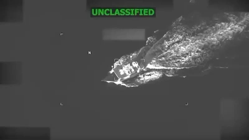
Four Killed in Latest US Military Strike on Suspected Drug Vessel in Caribbean
By Shermain Bique-Charles
Comments
Be the first to comment.